English
 日本語
日本語 မြန်မာ
 汉语
汉语 國語
國語 ภาษาไทย
 Magway’s history is closely related to that of other areas of central Myanmar. Its position alongside the Irrawaddy River has connected the Region to Sagaing and Mandalay upstream, as well as Bago, Irrawaddy and Yangon downstream, for centuries. During the first millennium, the Region was inhabited by Pyu people, a Tibeto-Burman population that dominated the central Myanmar flatlands at the time.
When the Burma Kingdom of Pagan emerged in the late 9th century, the Region began to form part of the core areas of the Burmese culture and civilization. The areas that now belong to Magway Region later formed part of the Third Burmese Empire and were ruled by the Konbaung Dynasty, which was the last dynasty that ruled the kingdom from 1752 to 1885.
Magway is the capital city of the Magway Region (formerly Magway Division) of Myanmar and situated on the banks of the Irrawaddy River. The Myathalun Pagoda, where many pilgrimages across the country go there, the beauty of Magway, located in the north of the city, is the landmark of Magway. Magway Region is famous for the cultivation of sesame and many kinds of nuts. Besides, there is Beikthano, an ancient city that was built 2000 years ago, where the Phyu lived, and now in ruin.
There are many sightseeing and interesting places to visit in the Magway region for local and international travelers. Some of them are situated in the Magway, Salay, Pakokku and Tha Yat townships.
Popular points of the region
Interesting places in the Magway region for the foreign travelers and locals are; Myathalung Pagoda, Shwe Ku pagoda, Tantkyitaung Pagoda, Shin Bin Maha Laba Man Temple, Yokesone monastery, Sasanayaunggyi monastery, Beikthano ancient city, Salay building, and Min Hla Fort. Moreover, there are many others; such as Min Buu Shwe Sat Taw, Phaung Taw Oo Pagoda, Sandaku monastery and Shwe Sat Taw festival is very popular.
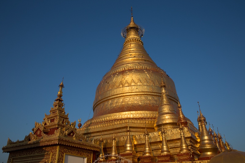
Myathalun Pagoda
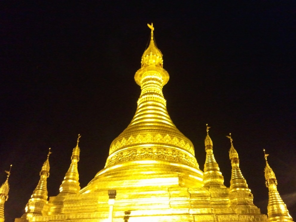 Magwe Myathalun Pagoda is located on the bank of Ayeyarwaddy River in Magwe, about 532km (331 miles) from Yangon.
According to legend, the pagoda was originally built by a wealthy man from Magwe named Thubawga. The original height of pagoda was 15.6 meters (52 feet) and it was extended to 24.6m by Bagan’s King Saw Lu (1077-1084), who enshrined 120 relics and seven gold Buddha images inside it. The pagoda was damaged by an earthquake in 1847 and later rebuilt to its present height of 31.2m.
Being the largest shrine in the region, the Mya Tha Lun Pagoda is attractive with its gleaming gilded stupa. The pagoda’s scenic beauty overlooking the riverbank makes a big impression on travelers. Mya Tha Lun Pagoda festival lasts from the 15th of October to the 2nd of November. There are many fascinating activities held in the festival such as Buddhist chanting in the early morning of nearly two thousand monks and the lightening of nine thousand candles.
Beikthano
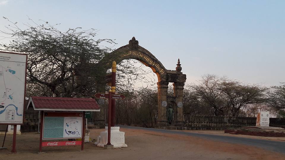 Beikthano situated in the irrigated Magway Region, near present-day Taungdwingyi. In the era of the Pyu city-states, it was a city of considerable significance, possibly a local capital replacing Sri Ksetra. Today the modest village is noted for its hot springs and archaeological sites. Beikthano, Hanlin, and Sri Ksetra, the ancient cities of the Pyu Kingdom were built on the irrigated fields of the dry zone of the Ayeyawady River basin. They were inscribed by UNESCO on its list of World Heritage Sites in Southeast Asia in May 2014 for their archaeological heritage traced back more than 1,000 years to between 200 BC and 900 AD.
Beikthano with direct land access to the well-watered Kyaukse plains to its northeast is the oldest urban site so far discovered and scientifically excavated site. Its remains—the structures, pottery, artifacts, and human skeletons—date from 200 BCE to 100 CE. Named after the Hindu god Vishnu, the city may be the first capital of a culturally and perhaps even politically uniform state in the history of Burma. It was a large fortified settlement, measuring approximately 300 hectares inside the rectangular (3 km by 1 km) walls. The walls and fortifications along it measured six meters thick, and are radiocarbon dated to a period between 180 BCE and 610 CE. Like most subsequent cities, the main entrance of the walls led to the palace, which faced east. Stupas and monastic buildings have also been excavated within the city walls.
In October 1996, Beikthano, Hanlin and Sri Ksetra were proposed to be inscribed on the UNESCO World Heritage List. This proposal was approved by UNESCO in the 38th session of the World Heritage Committee held in May 2014 in Doha, Qatar. According to the UNESCO report, the Pyu Kingdom prospered for over 1,000 years between 200 BC and 900 AD. All three sites are inscribed under Criterion (ii), (iii), and (IV) covering an area of 5,809 hectares (14,350 acres) with a buffer zone of 6,790 hectares (16,800 acres). The integrity assessment by UNESCO of the three sites is: "The completeness and reliability of dated archaeological sequences from the site, with the radiocarbon dates derived from intact architectural features dating back to 190 BCE, provide scientific proof of the entire one-thousand-year period of occupation of the cities, and reinforces paleographic dates provided by inscriptions in Pyu script on artifacts excavated at the site".
Shwe Ku Pagoda
It is said that the Shwe Ku Pagoda was built by the King A Laung Si Thu, who was legendary in the history of Myanmar. It is located in one of the big cities in the Magway region, in Pakokku. It is famous for the wooden carving artwork, which was craved over 100 years ago.
Tantkyitaung Pagoda
 Tantkyitaung Pagoda located across the Ayeyarwady River in Pakokku District, Magway Division, Myanmar (Burma) is a prominent Burmese Buddhist pagoda near the historic city of Bagan, believed to enshrine four tooth relics of Gautama Buddha.
It was built by King Anawrahta in 397 ME on Tantkyi Hill, where the royal white elephant bearing the tooth relics rested for the second time, after it sat at a place, market by Shin Myethna Thettawshay Pagoda, then at a place where heavy rains fell, market by Shin Mogaung Pagoda, and at a place where the elephant mustered its strength, market by Sin Min Thwin Pagoda.
Tantkyitaung Pagoda is 90 feet (27 m) high with a base of 60 feet (18 m). Its nine tiers of umbrella contain a silver vane and the diamond bud. It has been renovated in successive periods. It has an image of Lord Buddha, a statue of Ananda and that of the forest guardian. A look down from the pagoda platform reveals the head of a dragon protruding from the walling down below. It is said that the tail end of this likeness of the dragon is around the site of Shwezigon Pagoda.
Mann Paya Buddha image
The Mann Paya Buddha image is one such relic, a don’t-miss sight of the upper Dry Zone that most people have never heard of. Legend has it that local villagers spotted the hollow wooden statue – nearly 20 feet tall – floating downriver after heavy flooding in1888. They rescued it from the waters, dragging it ashore and coating it with gold lacquer. Nobody knows for certain who carved it, but its style suggests an origin date of around 1300 AD. The Mann Paya is believed to be one of the only lacquered Buddha images in the country and certainly the largest. Visitors used to be able to enter the statue via a portal around the back, but caretakers have barred the gate in recent years to preserve structural integrity. You can still peer into the depths of the Buddha, however, to see slats of wood stretching up into the darkness behind the eyes.
Yokesone Monastery
Yokesone Monastery is a historic Buddhist monastery in Sale, Magwe Region, Myanmar. The wooden monastery, which dates to 1882, is known for its abundance of woodcarvings which depict scenes of the Jataka tales.
The monastery was constructed with 153 teak posts, each more than 3 feet in diameter, which hold the building up about 10 feet above the ground, during the time of King Thibaw. It housed monks from its construction until it was transformed into a museum in 1996. Aside from the carvings, guests can also view an ancient Buddha image and utensils of the Yadanabon 19th century period. Additionally, the museum houses a plethora of unidentified sculptures, a large throne once used by leading monks, as well as an old wooden box that served as carriage for clergy members. Behind the monastery in a small building, work from the famous Burmese playwright and poet, as well as favorite bard in King Mindon's court, U Ponnya, also hailing from the area, are on display.
Sasanayaunggyi Kyaung
The monastery and meditation center Sasanayaunggyi Kyaung, 0.3 miles north of Paya Thonzu, is a stop-off point for day-trippers. It features a lovely 19th-century glass armoire with painted Jataka panels and 400-year-old scripture in Pali inside. The monks are usually happy to show you around, and always appreciate a donation for their on-site school.
Salay House
In 1906 the British Empire was fully in control of the Ayeyarwaddy River from the north of Bhamo to the southern seaport of Rangoon. Commerce ranging from precious rubies to old-growth teak flowed north to south along the river. Just before the turn of the century oil was discovered in the region just south of Bagan. This new commodity brought great wealth to the farmers and landowners of Salay and led to a "building boom" of Burmese-Victorian architecture in the town.
Dedicated on August 19, 1906, the Salay House was born in this era of prosperity. Today the Salay House allows visitors to experience the world of a British-Colonial trading company - the Ayeyarwaddy Royal Trading Company (ARTco). This restored riverside warehouse is filled with antiques to recreate the flavor of this historic time period. Learn and explore how British-Burma operated with displays and information panels or simply relax on the Salay House's outdoor deck with a snack or beverage.
Min Hla Fortress
The 150-year old Minhla Fortress was constructed in 1860-1861, during the era of Kanaung Mintha Gyi (Prince of Kanaung). A stone inscription at Minhla Fortress by the Department of Archaeology stated, “The structure was built with the help of Komoto Perry and Moli Naryi, the French and Italian engineers by young Myanmar men who had returned from studying abroad” The fortress is built in a shape of a square box, and the red bricks which were used for construction were 15 inches long and 6 inches thick.
In the backland of Minhla Fort is an entrance on the land and also a vacant plot with green grass. Along the four sides of the walls, there are 21 rooms which include rooms for the officers, troops and storage rooms.
There are two brick staircases in the interior to which are connected to the second level of the fortress and these staircases are at the north and south sides of the fortress.
Four furlongs north of the Minhla Fortress lays the telegraph office. The telegraph office used during the time of the Myanmar monarchy still stands today, located in the northern wing of the fortification and is recorded as one of the oldest in Myanmar history. Although wooden bargeboards were seen on the red zinc roofing of the telegraph office, nothing else in this 16 square feet room.
At present, the Minhla Fortress and the telegraph office are under the care of the Department of Archaeology.
Transportation
Upon your budget and preferred transportation, you can reach Magway by car, air or boat. It is around 378 miles from Yangon by waterways and 330 miles by road.
When to visit Mgway State
The best time to visit Myanmar is between November–February. During the cool season, it offers warm temps with relatively dry air – but keeps in mind this is peak tourist season, so expect crowds and higher prices. However, the Mgway State is located in the dry zone of the country and so, you can expect a sunny days at any time.